Marine Weather
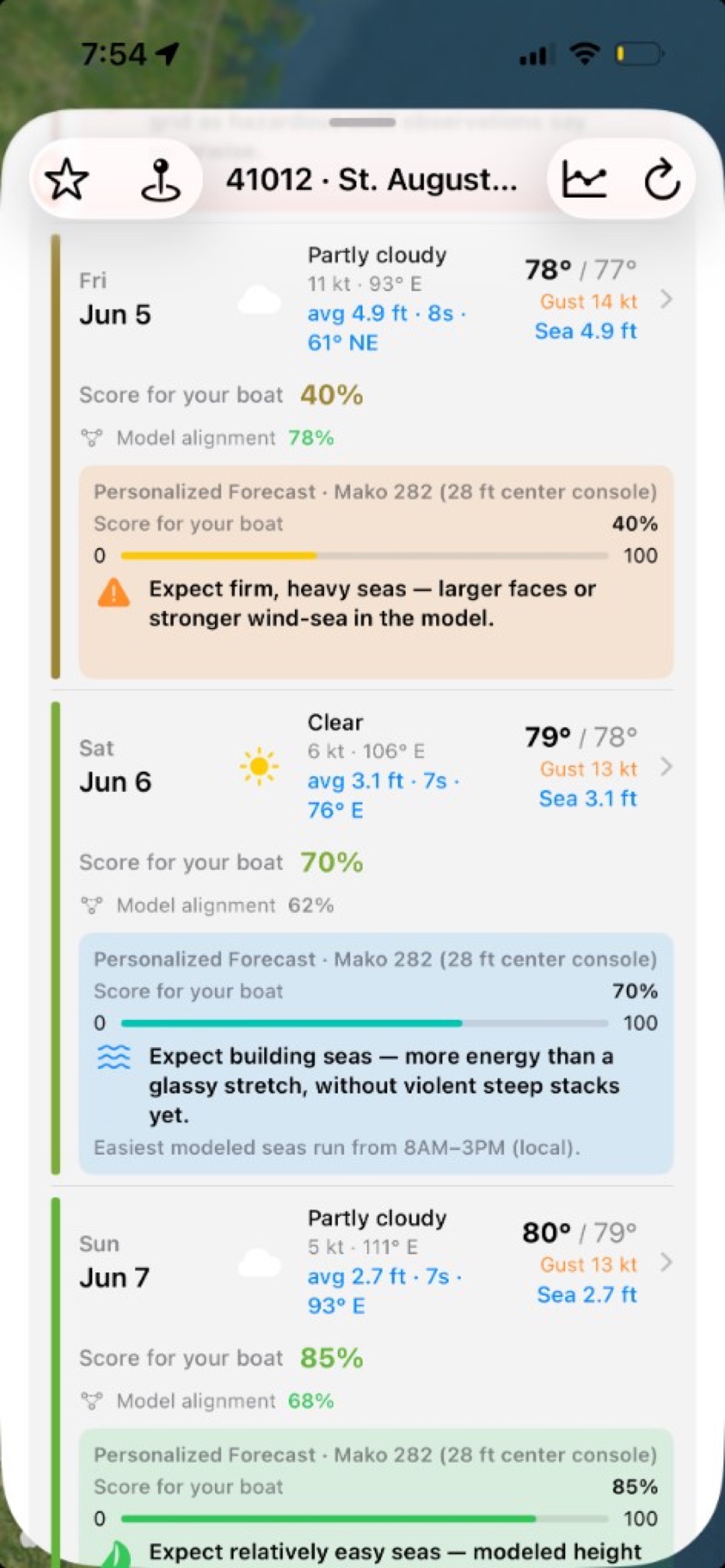
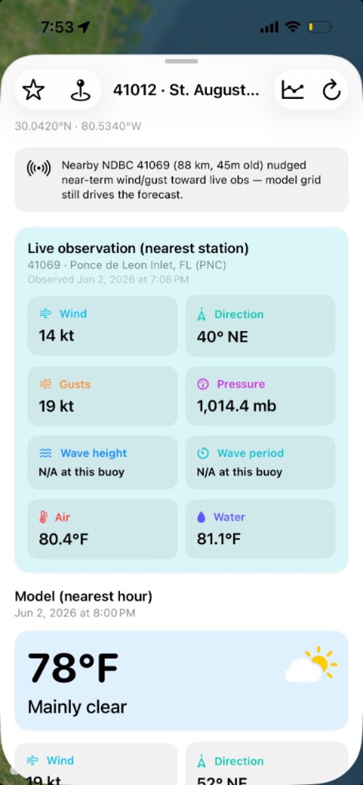
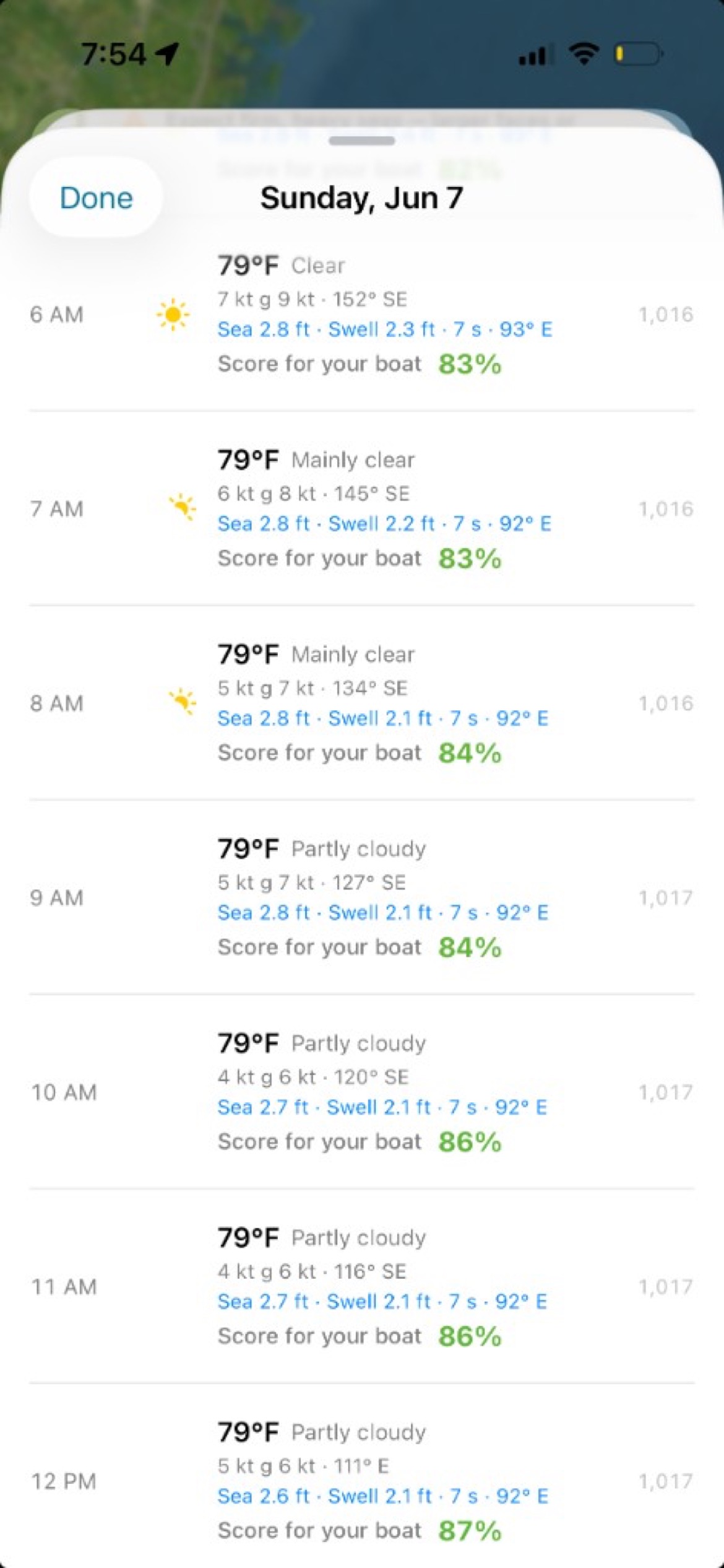
Tap any spot for multi-day forecasts, hourly wind and waves, live NDBC observations, NOAA tides, and a Personalized Forecast scored for your boat.
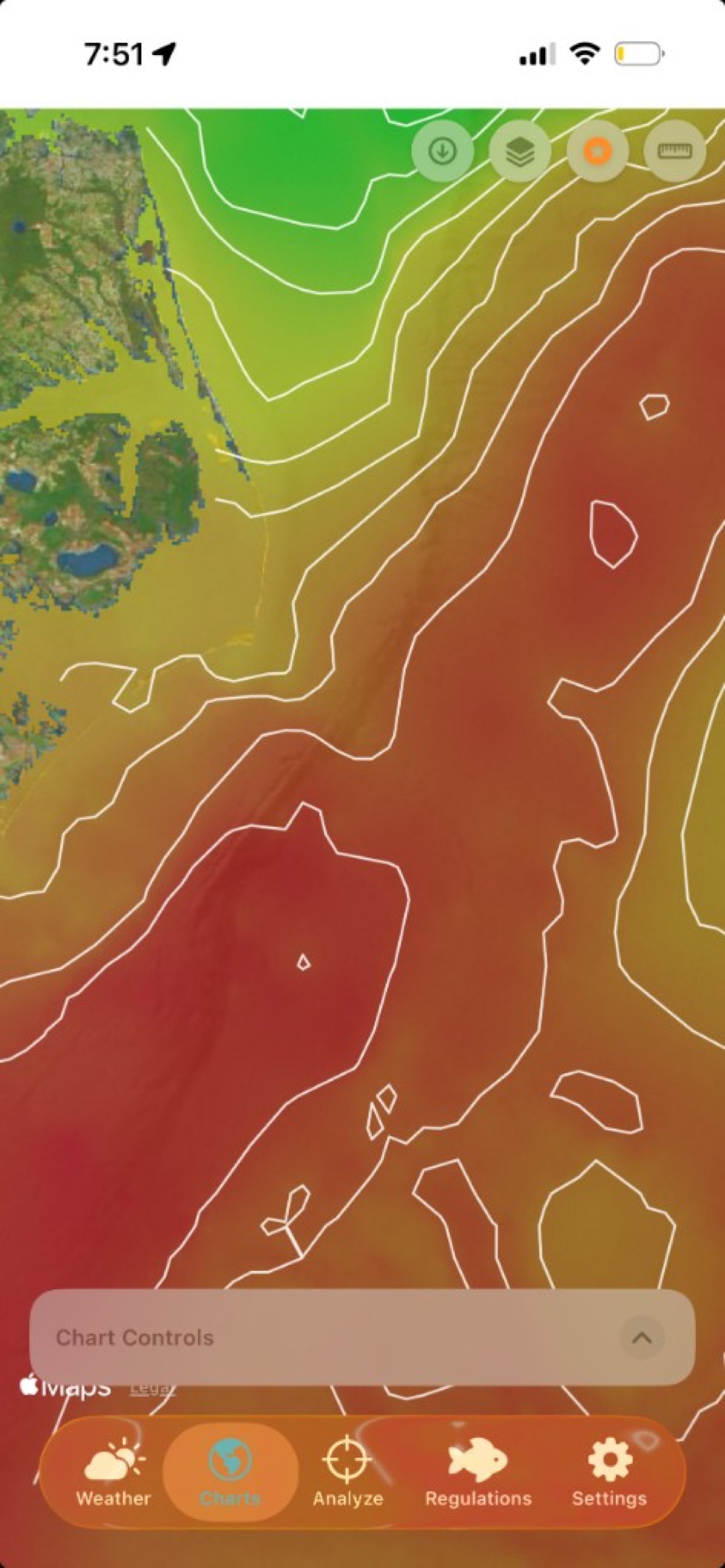
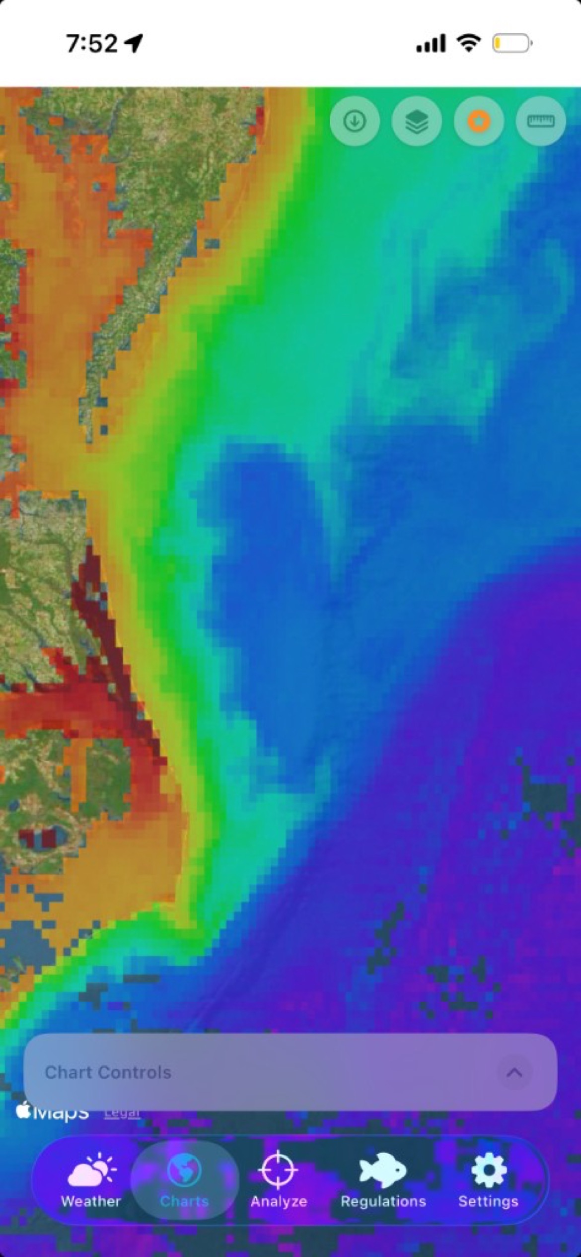
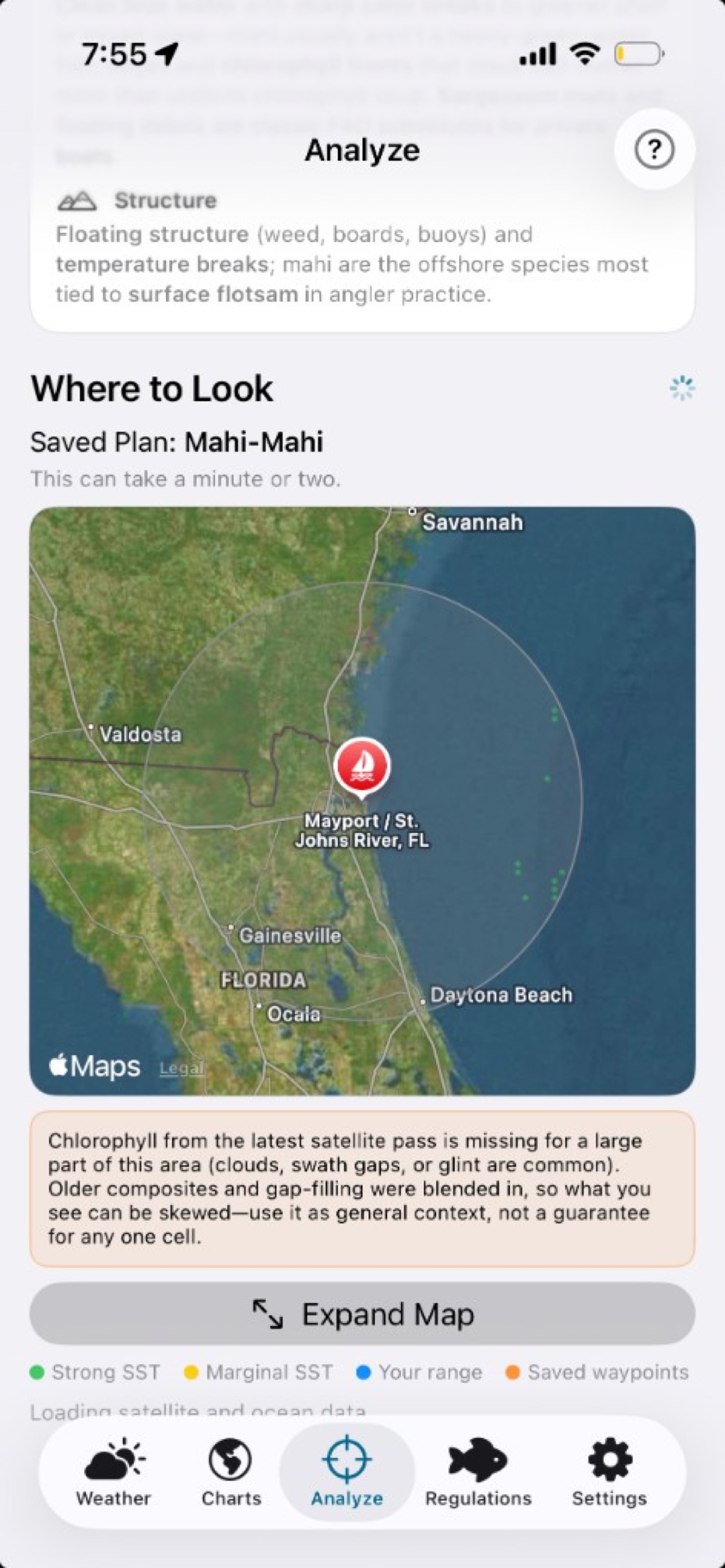
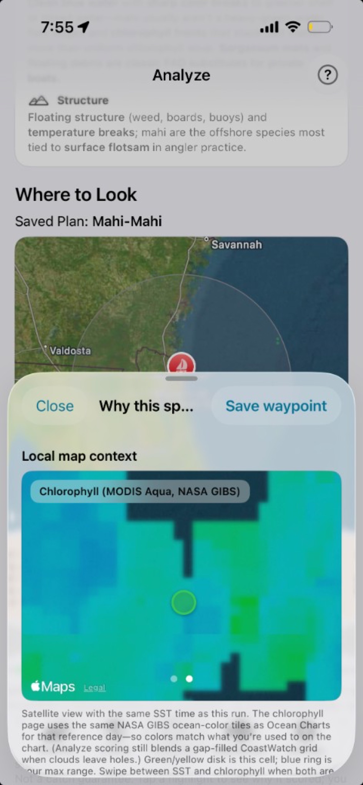
Tap the map for spot forecasts, overlay satellite SST and chlorophyll on charts, rank habitat hotspots for your target species, and check Atlantic & Gulf regulations — all in one iOS app built for the East Coast and Gulf.
Free tier includes core maps and 3-day forecasts. Premium adds extended outlooks, Analyze, Regulations, satellite layers, and more. Not for navigation — always verify with official sources.
Live buoy data, model forecasts, satellite ocean layers, and species-aware habitat hints — designed for Atlantic and Gulf runs.
Tap any spot for multi-day forecasts, hourly wind and waves, live NDBC observations, NOAA tides, and a Personalized Forecast scored for your boat.
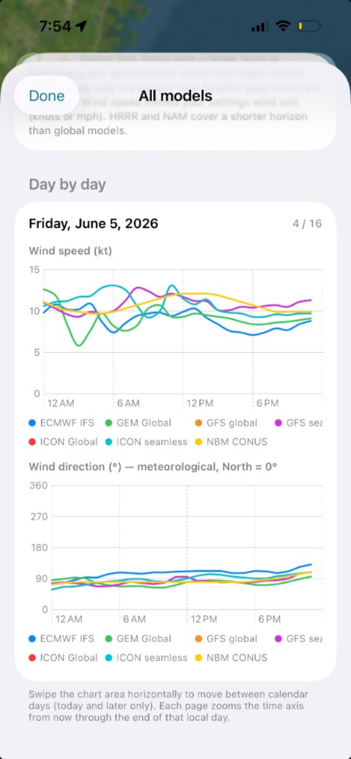
Layer sea surface temperature, chlorophyll, bathymetry, and seafloor relief on an interactive chart. Measure distance and save waypoints.
Pick a species, departure inlet, and range. SwellSnap blends SST, chlorophyll, currents, and depth into ranked hotspot suggestions with reasoning.
Premium bundled Atlantic & Gulf saltwater summaries with federal and state rule cards. Always confirm with official agencies before you keep fish.
Tap a screenshot to preview it in the hero frame above.
14-day free trial for new subscribers, then about $12.99/month. Billed through Apple — cancel anytime in App Store settings.